Google is doing a little design housekeeping by redesigning its Maps have a have a cleaner look, free from clutters.
A month after updating its satellite imagery with higher resolution photos, Maps now should be easier to understand.
The goal, according to the company, is to balance information without overcrowding the already crowded maps. To do this, Google is removing elements "that aren't absolutely required."
This means, users won't see any more road outlines.
And for an added benefit, the company is also changing the typography to help highlight key areas of interest so they can stand out more. The new typography should make Maps' elements to stand out and become more readable.
But the main highlight of the update is Maps having "areas of interest."
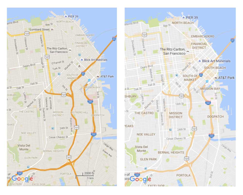
Here Google is helping commuters to seek out places they may want to visit by shading them in orange. Users can zoom into these orange places to find out more details about them. To know which places are actually areas of interest, Google determines them using algorithm that measures the concentration of businesses in the area. But to larger places, Google still needs humans to locate those places.
These areas are determined by "an algorithmic process that allows us to highlight the areas with the highest concentration of restaurants, bars and shops," said Google in its blog post.
And to make things easier for users, Google has made a little color chart so people can identify places by just looking at the color code. The new colors should also make it easier to differentiate between man-made and natural features, as well as quickly identify important structures like hospitals and schools.

The updates are rolling out to all version of Google Maps.
Previously, the team at Google Maps was introducing a Wi-Fi only-mode. The additional mode is found in the settings of Google Maps and replaces the "Offline areas" option. Once the feature is activated, Maps will load the majority of the data through Wi-Fi signals. Small data might still be consumed though, as a warning notifies users.
The team at Maps also brought more crowdsourcing tools to its mobile app.