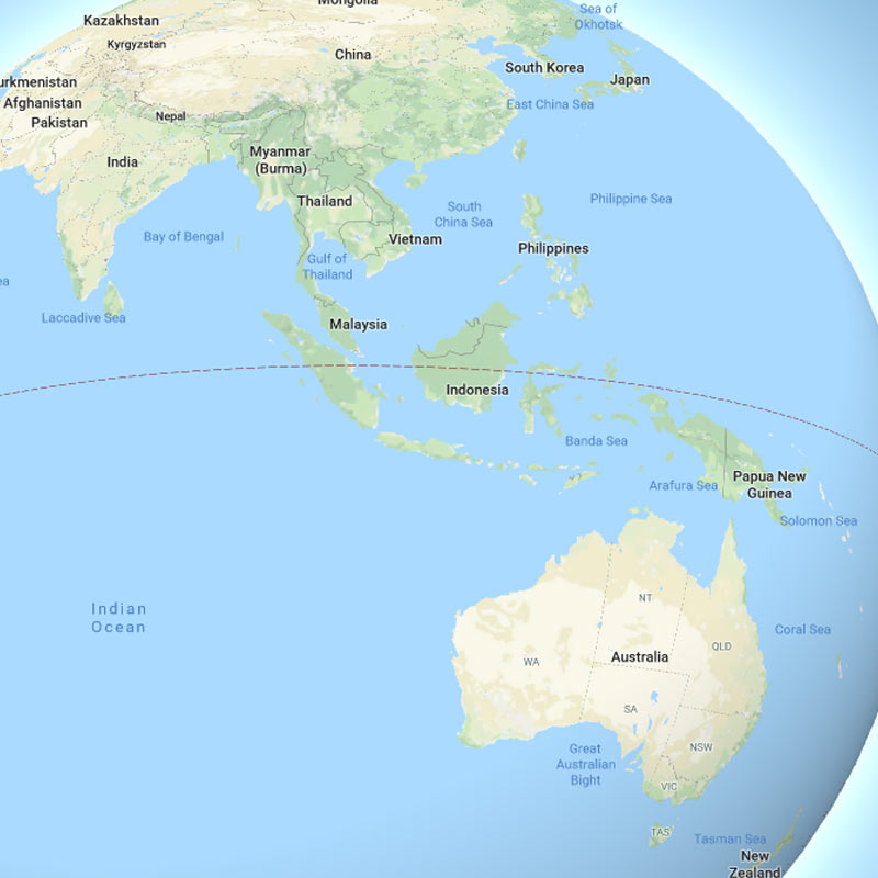
In a series of update, Google introduced a new look for Google Maps when users zoom all the way out.
Previously Google Maps showed a flat Earth, because it has used Mercator projection. This is a cylindrical projection that basically covers the globe in a cylinder and then projects each point on the sphere onto a flat surface.
While this style makes it easier to display things onto maps and preserves the shape of countries and continents, the standardized projection however distorts the image of the Earth. For example, things that are located around the equator are to scale relative to one another, and while objects closer to the poles appear larger than they really are.
What this means, using Mercator projection, Greenland appears larger than Africa, when in reality, Africa is actually 14 times larger.
Africa also appears to be roughly the same size as Europe, when in reality, Africa is nearly 3 times larger. Alaska takes as much area on the map as Brazil, when Brazil's area is actually nearly five times that of Alaska. Finland appears with a greater north-south extent than India, although India's is actually greater. Antarctica also appears as the biggest continent, while it is actually the fifth in area.
With 3D Globe Mode on Google Maps desktop, Greenland's projection is no longer the size of Africa.
Just zoom all the way out at https://t.co/mIZTya01K3 pic.twitter.com/CIkkS7It8d— Google Maps (@googlemaps) August 2, 2018
Google Maps is showing Earth as a globe, in order for it to accurately display the Earth and its layouts. The company highlighted the change on Twitter, saying that with the 3D Globe Mode, "Greenland’s projection is no longer the size of Africa."
But since ditching Mercator projection entirely will make it difficult for navigating, the 3D Globe Mode update essentially introduces a hybrid approach.
When users zoomed in for turn-by-turn navigation and a view of the city, Maps is showing things as if nothing has changed. However, when users zoom out, the map will gradually begin to round out the further they go, showing users a fish-eye view before completely rounding out the Earth into a globe.
After showing the Earth as a globe, users can spin it around to see all the countries and bodies of water in the size and shape that they were always meant to be.
Back in 2009, Google explained that it uses Mercator map because it helped preserve angles of roads:
"The first launch of Maps actually did not use Mercator, and streets in high latitude places like Stockholm did not meet at right angles on the map the way they do in reality."
Adding another dimension to Maps should take care of the issue of Google displaying incorrect proportions when using the flat view of the Earth, especially as users move further away from the equator. And using the hybrid approach, Google can benefit from both.
Initially, the change is available for users using Google Maps on desktop interface, on any browser that supports the WebGL API, which renders "interactive 2D and 3D graphics within any compatible web browser without the use of plugins."