Myanmar, formerly known as Burma, is a Southeast Asian country rich in history, culture, and natural beauty — but also marked by complex political challenges.
It borders India, Bangladesh, China, Laos, and Thailand, with a long coastline along the Bay of Bengal and Andaman Sea. The country’s landscape is a mix of coastal plains, river basins, dense forests, and rugged highlands. Its capital is Naypyidaw, a purpose-built administrative city, while Yangon remains the country’s largest and most commercially vibrant city.
But what the country which has a population of about 55 million people is also known for, is for bring one of the most seismically prone countries in the world.
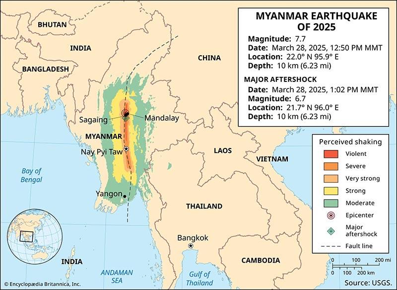
On March 28, 2025, Myanmar experienced a devastating 7.7-magnitude earthquake that not only caused widespread destruction, but also yielded an unprecedented scientific observation.
This is because a CCTV managed to record the first-ever video recording of a surface fault rupture during an earthquake.
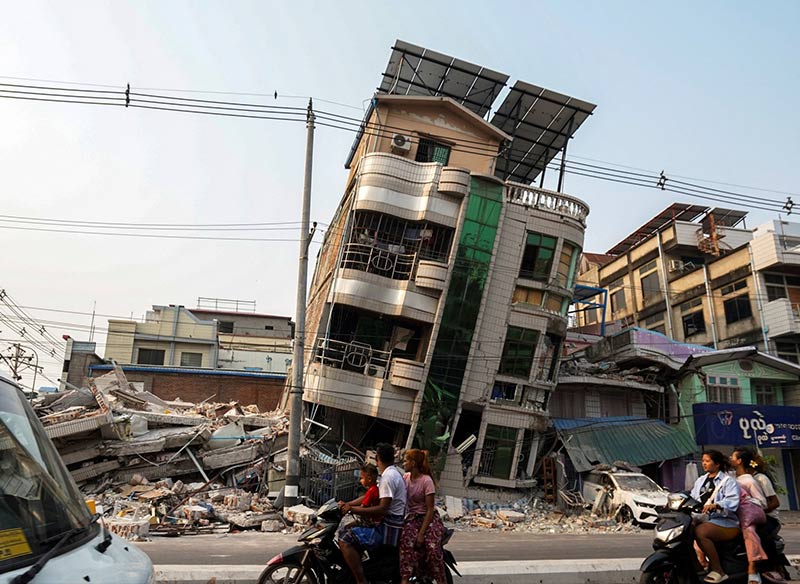
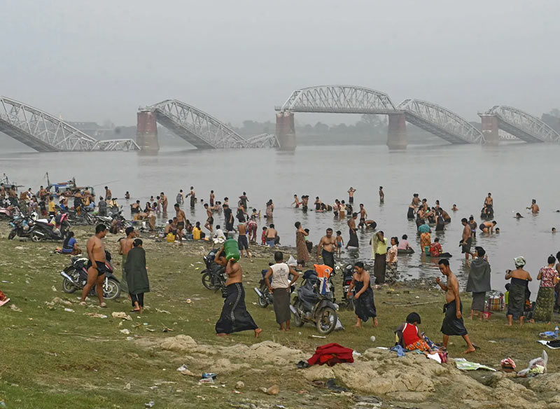
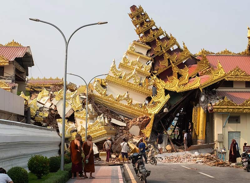


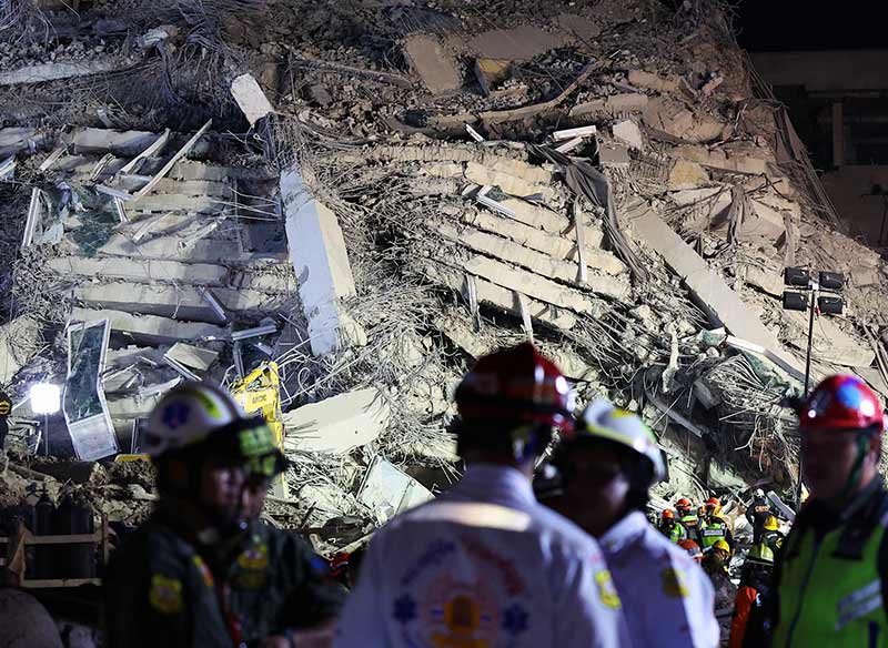
Myanmar's geological structure is heavily influenced by the Sagaing Fault, a major right-lateral transform fault that spans over 1,200 kilometers from north to south.
This fault forms a tectonic boundary between the Indian Plate and the Sunda Plate, slicing through some of the country's most densely populated areas, including Mandalay and the administrative capital, Naypyidaw. The Sagaing Fault has a long history of seismic activity, having triggered numerous earthquakes over the past century — including several powerful ones in the magnitude 7 to 8 range.
The March 2025 earthquake stands out because it lasted approximately 80 seconds, and also resulted in significant destruction across Myanmar and neighboring countries.
It was the most powerful quake to hit Myanmar since 1912, causing over 5,000 fatalities and extensive damage to infrastructure.
But the earthquake is only known for its strength but also for the sheer scale of its rupture.
The fault break extended approximately 460 kilometers, making it one of the longest surface ruptures ever recorded.
And what makes this event even more extraordinary is that it was captured on video — an exceptionally rare occurrence in seismology.
The now-viral surveillance footage from Thazi, captured during the May 2025 earthquake by a security camera at GP Energy Myanmar’s Thapyawa solar farm, offers an extraordinary glimpse into the Earth's seismic behavior.
In the video, the ground is visibly cracking and shifting—a direct, real-time recording of a fault rupture in action. For seismologists and geologists, this is nothing short of a scientific treasure.
Earthquakes are notoriously unpredictable, and their violent shaking often renders surveillance equipment inoperable. Cameras are rarely positioned in exactly the right place, at exactly the right moment. Yet in this case, everything aligned — and the result has astonished the scientific community.
The footage provides researchers with a first-hand visual of a surface rupture unfolding, something previously only theorized or inferred through aftermath analysis.
It offers an unprecedented opportunity to study fault dynamics as they happen, rather than retroactively. This is critical for refining seismic models, improving building codes, and advancing early warning systems that could one day save lives.
More than just a compelling visual, the Thazi video represents a milestone in earthquake science and disaster documentation.
It also underscores the urgent need for more robust, strategically placed monitoring systems in tectonically active regions. With better surveillance, we inch closer to understanding — and perhaps better preparing for — the incredible forces at play beneath our feet.