While different countries may have their firepower varied immensely, there is only a few countries that tops the world's military strength, and manages to keep the title for years.
And without a doubt, the U.S. comes on top, based on its potential war-making capability across land, sea, and air fought by conventional means.
Based on the nation's manpower, equipment, natural resources, finances, and geography, the U.S. is the most powerful with a power index of 0.0718 (a score of 0.0000 is considered 'perfect'), according to Global Firepower, which has been documenting analytical display of data concerning 140 modern military powers.
Among the reasons the U.S. is the most powerful in terms of firepower, is its control of some of world's most powerful aerial machineries.
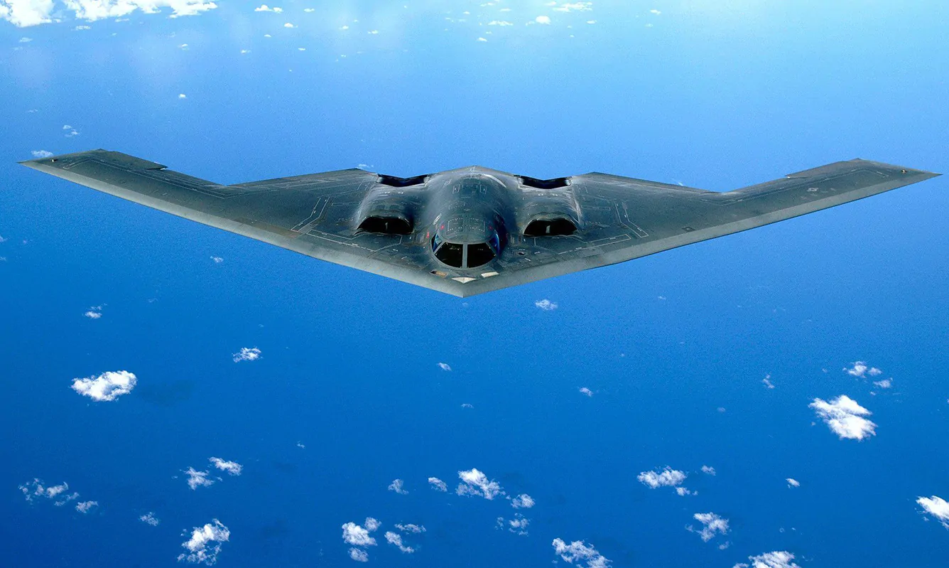
And among the most powerful at the nation's disposal, is the Northrop Grumman) B-2 Spirit.
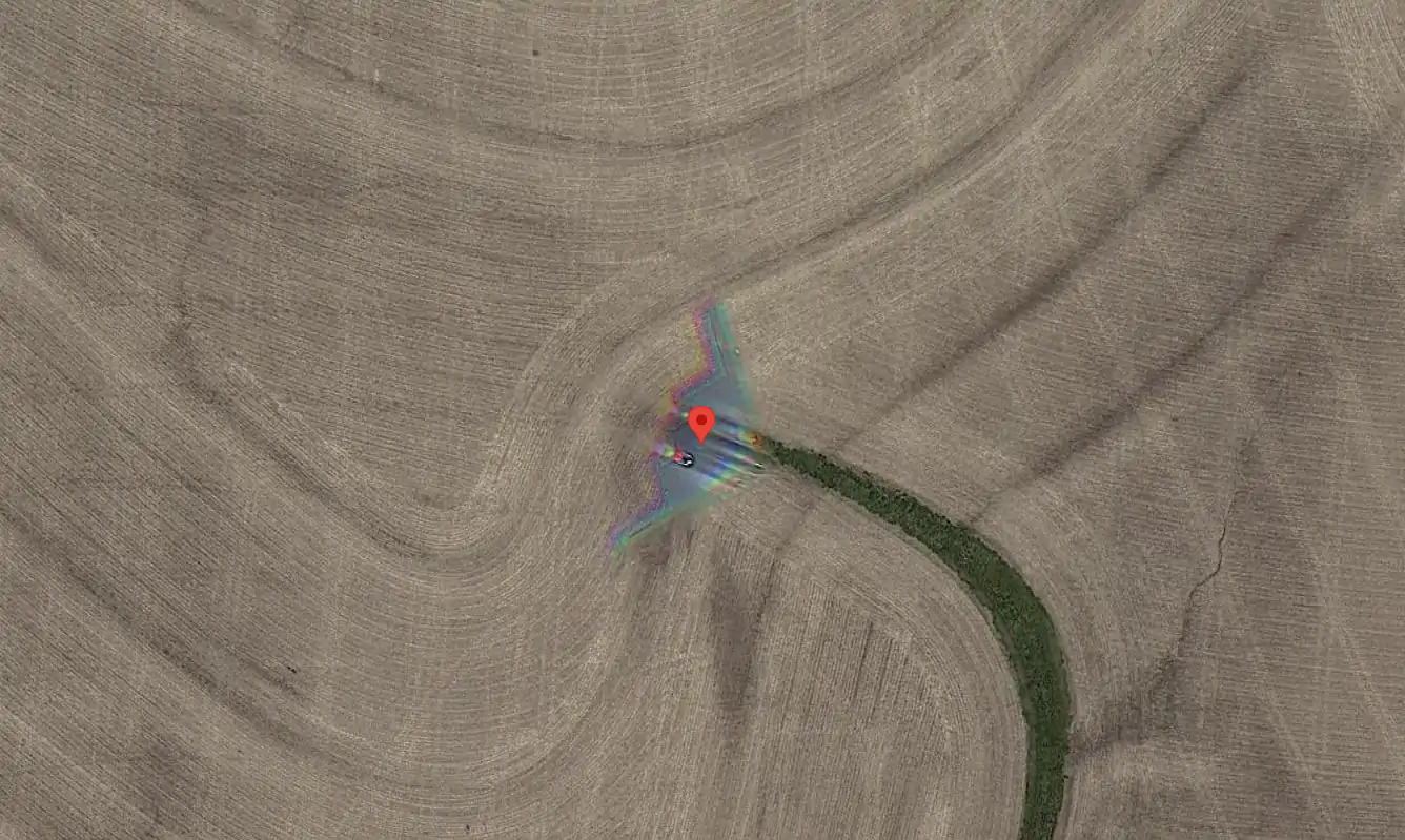
And this time, the plane was caught on Google Maps, the web mapping platform and consumer application offered by Google.
The B-2 Spirit, also known as the Stealth Bomber, is a heavy strategic bomber that features low observable stealth technology designed for penetrating dense anti-aircraft defenses.
While it was initially designed during the Cold War, and had its maiden flight in 1989, the planes retain their prowess, and are still acknowledged as the only planes capable of carrying large air-to-surface standoff weapons in a stealth configuration.
With a $2 billion price tag for each unit in 1997 calculation, the plane that is capable of carrying up to 40,000 pounds (~18,000kg) of explosives, including nuclear weapons, essentially translates to death to opponents on the ground.
Google Maps provides satellite imagery, aerial photography, street maps, 360° interactive panoramic views of streets (Street View), real-time traffic conditions, and route planning for different methods of traveling.
And here, the mapping feature that is meant for civilian use, managed to catch the bomber mid air, while flying over farm fields in the Midwest, at Concordia, Kansas.
The stealth bomber was first discovered by Redditor Hippowned, who shared his finding on Reddit.
The exact coordinates are 39°01’18.5”,-93°35’40.5”.
As a plane made and purposefully created for stealth purposes, catching it on photograph when flying without the U.S military suspecting it is extremely rare.
Making things even more difficult, only 21 B-2 bombers were ever made.
Not to mention, because of the B-2 Spirit's considerable operating costs, and the U.S. possession of the 'cheaper' unmanned autonomous military drones, the military doesn't use the bombers that often.
Among the most recent times the bombers were used in real fight, was back in 2017, when two B-2s attacked an ISIS training camp in Libya.
Google has been working to photograph seemingly every part of the globe for its street and satellite views.
And by utilizing powerful cameras to capture anything down below, this can occasionally result in some unexpected photos.
The blurry look of the B-2 in the photo is not only because of the speed of the bomber, but also because of the satellite cameras captured photos for the red, green, and blue (RGB) channels separately before combining them into a single full-color image.
"Not much of a stealth bomber then huh?" said one Redditor.
"No one escapes Google," said another.
It's worth noting that this B-2 Spirit was spotted just 20 miles north of Whiteman Air Force Base, the home for all of the remaining 20 B-2 Spirit stealth bombers (1 crashed in 2008).
When the photo was spotted, at the Whiteman Air Force Base, another B-2 bomber can be seen near the runway.